CROSS COUNTRY FLYING AT VOSSVoss is a excellent place to fly cross country
with paraglider. A really big distance is a challenge here, but the valleys pointing in 5
differnt directions from Voss give you plenty of challenges and options on any wind
direction. Finding a safe landings is no problem because all the valleys have farmland and
grassy fields. And if you pay attention to the grass production on the fields you land
during the summer, you will not have any problems with the land owners. The height ceiling
for paragliders is 2800 meters above Voss. This is well above a normal cloudbase which is
normally around 2000 meters on xc days. If you go west you will meet the TMA of Bergen,
Flesland Airport after approx 20 km. You meet another TMA 50 km north, but south and east
you can fly FAAAAR.
 The most common xc flight is to head easterly towards Ulvik, about 30 km, or
fly northwards towards the Vikafjell high mountain platou. If you manage to cross it you
will make 50-60 km. The most common xc flight is to head easterly towards Ulvik, about 30 km, or
fly northwards towards the Vikafjell high mountain platou. If you manage to cross it you
will make 50-60 km.
NOTE:
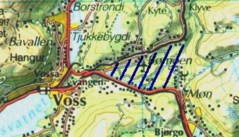
If you want to fly toward east
(Ulvik) you have to avoid the area around the lokal airstrip Bømoen. This area is a
dropzone for skydivers and landing area for sail planes and must not be crossed with a
paraglider in any altitude. We normally fly around this area by following the ridge north
of the airstrip untill the railway (black line) makes a sharp curve to the north.
East
The big crossing from Hanguren to the next good trigger point at Tverrberg east of the
airstrip is 7-8 kilometers and requires you gain good altitude before going. Normally
1600-1800m at Hanguren is sufficient. When you reach Tverrberg I recommend you try to stay
over the top of the mountain ridge and follow this towards Ulvik (30 km). Another route is
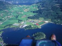
following the edge near the main road towards Granvin. Landing in Ulvik is on the soccer
field or nearby. It is possible to fly a few kilometers further to Osa, but retrieve will
become more troublesome due to very little traffic on that road. The best flight this
direction is Osa with 35 km.
|
 |
 |
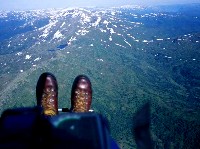
| Behind take off at
Tverrberg, facing east. |
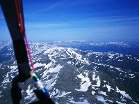
....follow the ridge over Hodnanuten..... |
Landing at soccer field in Ulvik, 30 km. |
North
If we want to fly north towards Vikafjellet, we normally drift back to Lonahorgi (1400 m,
big antenna). This mountain side faces a bit east, so you can fly here early in the day.
Stay on the left hand side of the valley, or later in the afternoon, after reaching the
antenna you cross the valley to Liaset north of the lake Lonavatnet and follow the west
facing ridge to Vinjo. After appox 30 km you will reach Vikafjellet high mountain platou
which is difficult to cross. (Crossed in 1999 and 2001). The
record this direction is about 60 km to Vangsnes (Ronny Olsen, Bergen).
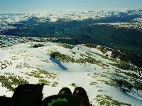 |
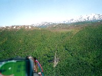 |
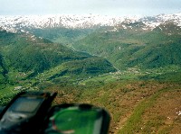 |
| Towards the antenna
at Lønahorgi |
Crossing over to Liaset on east side |
Follow the ridge towards Vinjo |
West
Toward west you can fly to Evanger, about 17 km. Flying further is difficult and risky
because of the fjord and few landing areas, and you also reach the TMA of Bergen Airport
(1600m). Best westerly flight is approx 45 km.
Note TMAs and height restrictions:

|
 The most common xc flight is to head easterly towards Ulvik, about 30 km, or
fly northwards towards the Vikafjell high mountain platou. If you manage to cross it you
will make 50-60 km.